Combine your experience with our science

Do you manage your whole farm as if it were uniform? It isn’t.

Every tree and every zone responds differently depending on soil, topography, crop development or water availability. We measure every tree and take water where it pays off most.

CSIC knowledge-based company (EBC) · Institute for Sustainable Agriculture (IAS-CSIC), Córdoba (opens in a new tab)

Anticipate, know, optimise

Three ways to work a farm that is not uniform.

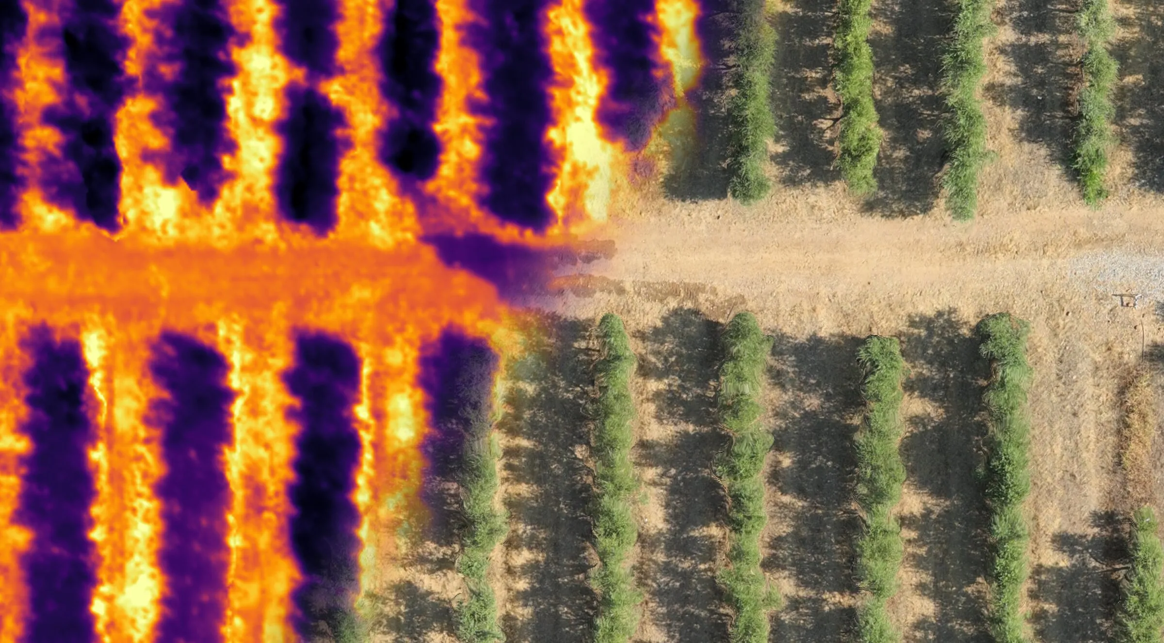
Top-down view of a drip-irrigated orchard: the left half in thermal imagery, with cool canopies on hot soil and the trace of a leak; the right half in true colour.

Anticipate

Spot differences and needs before they become problems.

  • Thermal drone

    It checks the irrigation system — leaks or clogged emitters — and shows the variability of the orchard and damaged trees, for example by the Capnodis rootborer in almond.

  • Do you have a drone?

    You fly, we process the images and every issue reaches SAQIA as a task for your team.
Thermal drone and leak detection

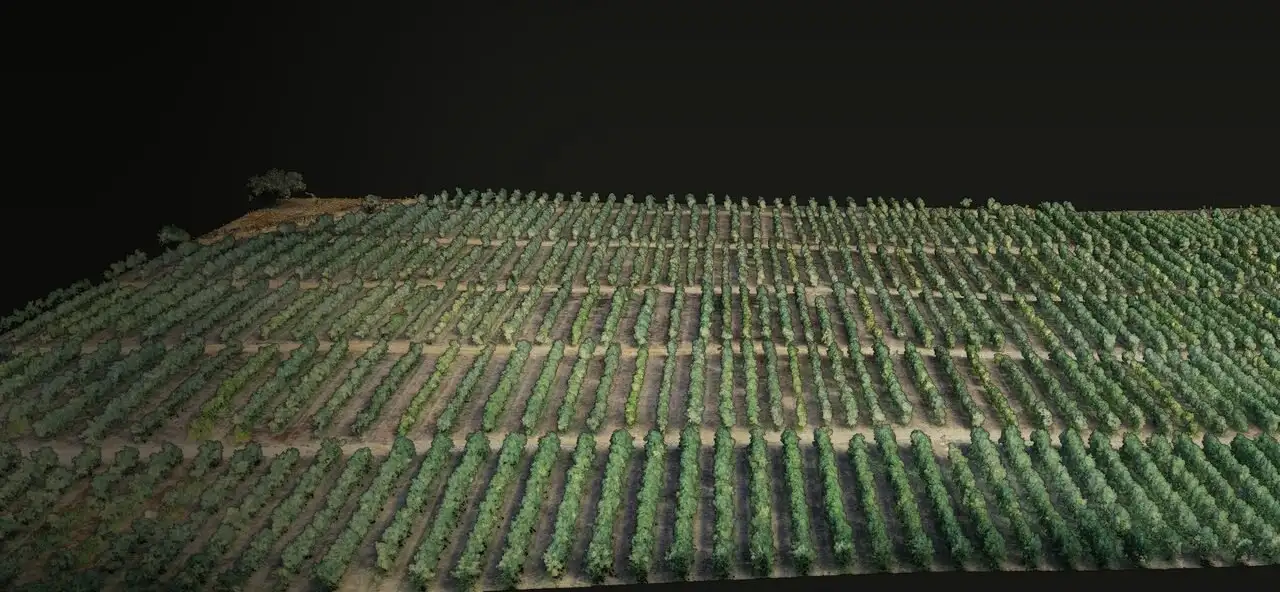
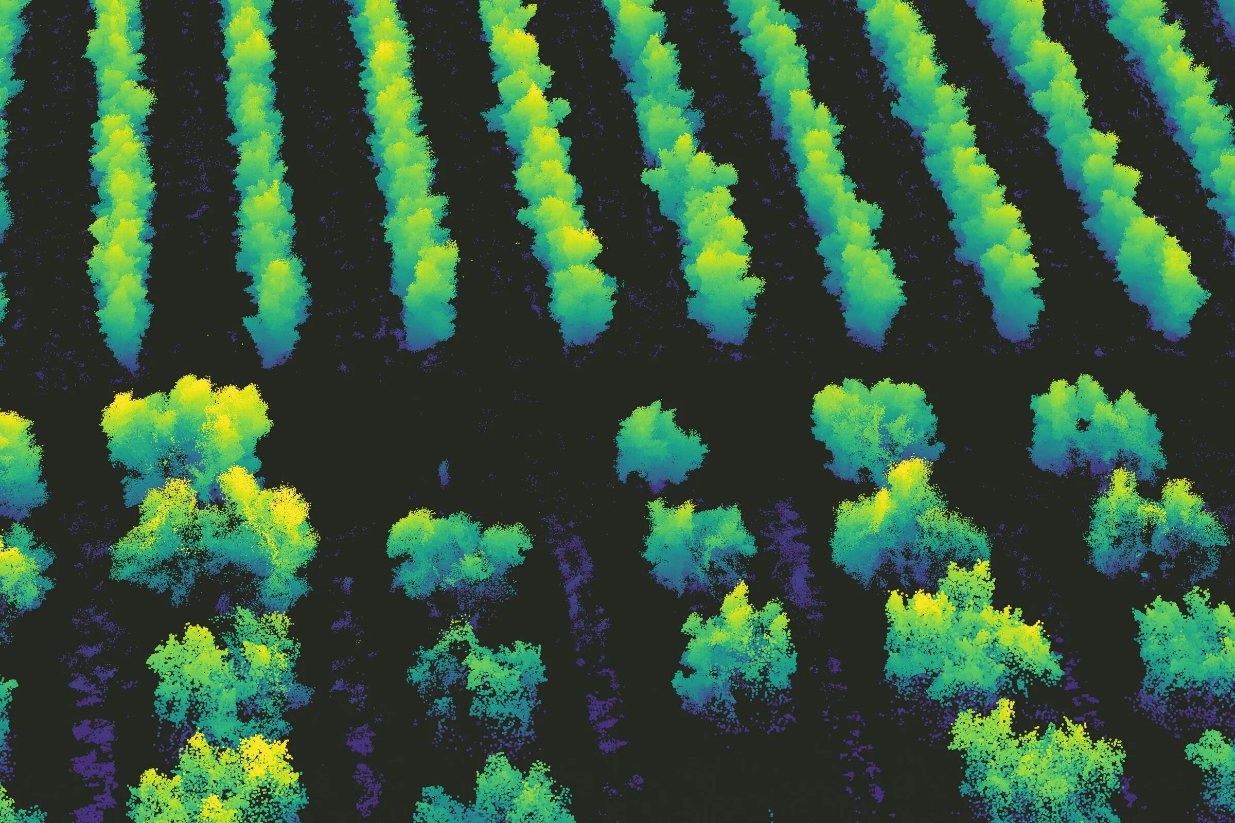
Aerial LiDAR point cloud of an orchard with trees coloured by height.

Know

The structure, vigour and condition of your crop, and how it responds to what you do.

  • Every tree in 3D

    Aerial and ground LiDAR: canopy volume, height and density, tree by tree.

  • Trials on your own farm

    How does your farm respond to water, to a fertiliser or to a new practice? We design and follow the trial with you to learn what really works.

LiDAR characterizationTrials and consulting

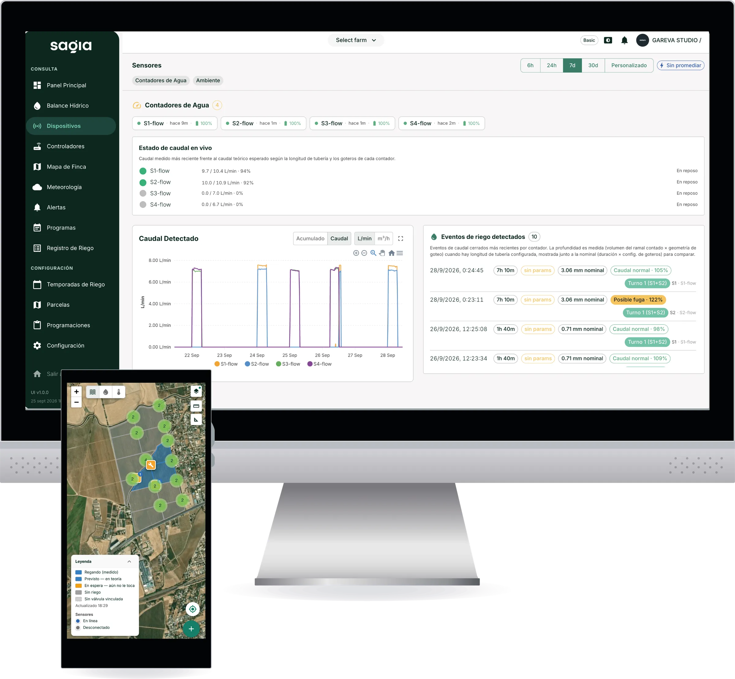
SAQIA on a desktop computer, showing sensors, detected flow and irrigation events, and on a phone, showing the farm map by sector.

Optimise

Match irrigation and management to the reality of your farm.

  • Thermal sensors

    The water status of each sector, day by day, with the water balance updated in SAQIA.

  • Agronomic and technology consulting

    IAS-CSIC judgement to turn data into irrigation and management decisions.

SensingAgronomic consulting

We measure every tree

We measure every tree and take water where it pays off most

Within a single sector, large and small trees grow side by side, some vigorous, some stressed. If they all receive the same allocation, some get too much water and others fall short just when the harvest is being decided. We measure every tree to group together the ones that need the same, and match each sector’s irrigation to its real size.

  • Tuned irrigation

    Matched to the real size of the trees in each sector.

  • A more uniform orchard

    In yield and in profitability.

  • Water balance

    Updated every day.

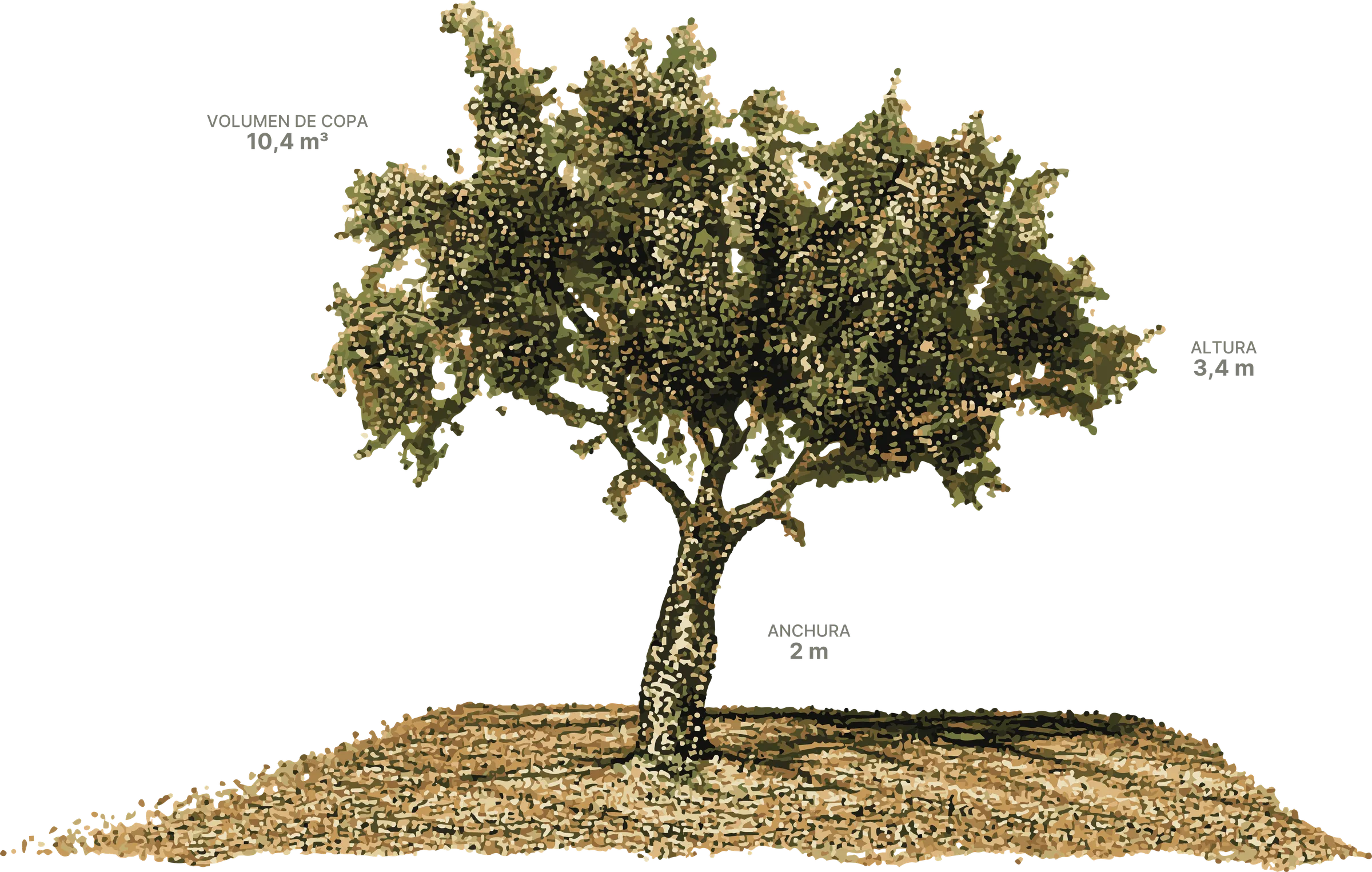
A pistachio tree reconstructed in 3D with its measurements: canopy volume 10.4 m³, height 3.4 m and width 2 m.

From data to decisions

It is not about generating more data, but about helping you make better use of it.

  1. We measure every tree

    With aerial and ground LiDAR (3D), we analyse volume, biomass and leaf density tree by tree to match water to what the crop actually needs.

    LiDAR characterization: We measure every tree
  2. We plan

    It is not about installing technology for its own sake. We work out which data add value in your case.

    Agronomic consulting: We plan
  3. We instrument

    Sensors, irrigation-head control and valves communicate over a radio network of your own that covers the whole farm.

    Sensing: We instrument
  4. We monitor

    We follow water status in real time with temperature sensors and check that every irrigation is applied as programmed, to keep the water balance up to date.

    Thermal drone and leaks: We monitor
  5. We decide

    We schedule the amount of water your farm needs from the integrated water balance and local weather.

    SAQIA: We decide
  6. We act

    SAQIA executes the plan on your valves; you supervise.

    Irrigation automation: We act

How SAQIA works

The goal is measured in your accounts, not ours

In an irrigated tree crop, watering with the right judgement at the right moment has a direct effect on yield. Our minimum working target is a 5% yield improvement — and with your farm’s LiDAR baseline, it gets documented, not promised. Add the foreman hours that disappear when irrigation runs itself, and the option of irrigating at night on off-peak electricity.

The infrastructure is yours

The gateway, the weather station and the sensors become part of your farm’s assets from the day of installation. So does the data. No perpetual rentals, no dependence on network operators — built on the industrial LoRaWAN standard.

  • 10

    pilot farms in Andalusia

  • 50+

    scientific publications by the team

  • Since 2009

    pioneers in drone thermal remote sensing

Born at the IAS-CSIC

Asymetree is a CSIC knowledge-based company (EBC, Empresa de Base de Conocimiento) born at the Institute for Sustainable Agriculture (IAS-CSIC) in Córdoba, Spain. We take years of research by the Department of Agronomy and the AgroPhenoLab group out into the field: water–plant relations in Mediterranean tree crops, and the ability to measure them with drones, in-house sensors and phenomics. Today we apply it on 10 pilot farms in Andalusia.

  • Alejandro Aguilar Chacón
  • José A. Jiménez Berni
  • Rafael Orozco Morán
  • Gabriel Soriano Gayarre
Meet the science and the team

How we work

  1. Technical visit

    We see your farm and how you irrigate today

  2. Proposal

    Matched to what your case needs

  3. Flight

    Delivered within 4-6 weeks

  4. Installation and training

    Sensors, network and a trained team

  5. Service up and running

    Within 8-10 weeks

The best time to get in touch is before the irrigation season starts: that way the flight and the sensors are ready when the decisions that matter begin.

Tell us about your farm

Tell us what you grow, how much land you manage and your main challenge. We reply within 48 working hours with concrete next steps for your farm.

Write to us